GNSS Performance Enhancement in the Low Magnetic Latitude Region and Its Evaluation
Air navigation based on GNSS (Global Navigation Satellite System) is globally available by receiving radio signals from satellites. However, GNSS is affected by various phenomena along the propagation path of the GNSS signals. Among various error sources, the ionosphere is the most variable and its variability is difficult to predict.
The performances of GNSS-based air navigation systems in Japan are limited by active ionospheric conditions in the low-latitude region. The ICAO (International Civil Aviation Organization) started providing information on space weather, including the ionosphere. Space weather information including, but not limited to, that provided by ICAO improves situational awareness of the ionosphere for us. We utilize such information to develop technologies to refine GNSS-based systems resolve issues when the performance is degraded. We also develop a performance assessment technology for Category-II/III GBAS (Ground-Based Augmentation System) suitable for Japanese airport environments, including low-latitude ionospheric conditions.
We promulgate our technologies to countries/areas in the low magnetic latitude region via international collaboration. Our goal is to realize an environment where GNSS-based safe air navigation is widely available within the low magnetic latitude region, including Japan.
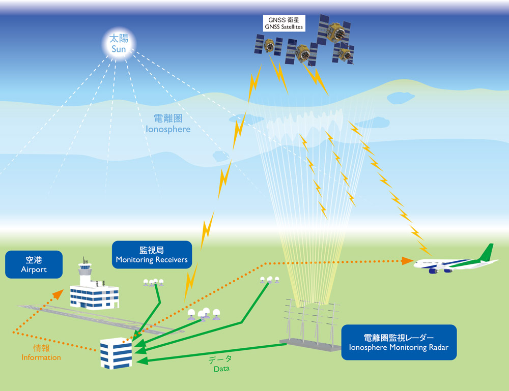
Radio waves from GNSS satellites pass through the ionosphere to reach Monitoring Receivers and Ionosphere Monitoring Radar. The data received by the Monitoring Receivers and Ionosphere Monitoring Radar is collected and delivered to Airports and Aircraft as information.