CARATS Open Data related information
This site is a compilation of information related to CARATS Open Data by the Electronic Navigation Research Institute.
CARATS is a long-term vision for the future air traffic system, and flight track data and weather data are widely available to promote CARATS.
The "3. Provision of CARATS Open Data" section describes how to obtain CARATS Open Data.
This website aims to enable to get the latest information of the data for users at any time.
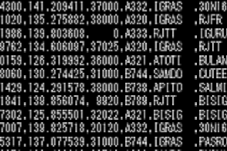
Overview of CARATS Open Data (track data)
CARATS Open Data (track data) are converted from the actual instrument-flight-rules (IFR)-scheduled-flights data recorded in the ATC radar system information and flight plan databases.
overview_CARATSOpenData.pdf (PDF 586KB)
Tools for CARATS Open Data
The tools require Java Run Time Environment version 8.
last update date 2022.10.17
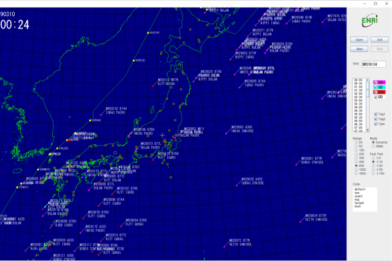
PlotTrack
This tool can display movie image of aircraft movements in the air.
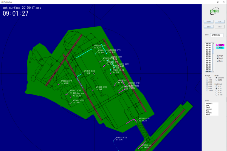
PlotSurface
This tool can display movie image of aircraft movements on the airport surface.
MakeApt
This tool can estimate the departure/destination airport from track data.
ENRI reserves all rights of contents on this site. Do not redistribute any properties available on this site. You can make links from other web pages to this site. Indicate source if you are publicating some results obtained using tools provided by this site. We are not responsible for any consequences that may result from the use of these tool. Use these tools at your own responsibilities.